Based on the Ordnance Survey map and the gpx file I had
downloaded onto my GPS the Coed Morgannwg Way should start at a Bike Park near Methyr Tydfil. I say "should" as there were no signs or waymarks to indicate the start of a long distance footpath, none of the white footprints on a brown background that are
said to define the trail. Nevertheless, on a Sunday morning the Bike Park was full of people on muddy mountain bikes, milling around, and there was a cafe where I bought some bottled water to replace the bottle I accidentally left in the car. (I could have taken the train to Methyr and walked to the start of the trail from there, but my kind, long suffering wife dropped me off (minus a water bottle).
I soon left the lycra - clad bikers to their extreme paths and followed the direction indicated by my map and GPS (the two closely followed each other). After a short section of farm track they lead me over a stile and then my troubles began. I think it unlikely that the person who defined this section of the Coed Morgannwg Way on the map ever actually set foot on the ground. If they had done so, they would have realised that while it may be "open access" land, across which you can legally roam freely, in the event, dense woodland, brambles and fences actually means you cannot. I zig zagged across the ground attempting to find passable routes in the general direction indicated by the map. This resulted in me retracing my steps several times as I found paths, little and larger that I could follow, and stiles across fences.. Even public footpaths on the map seemed to have limited reality on the ground, all without signs, many long overgrown, blocked by fallen trees and apparently little used. Some of those paths that I followed seemed to me more used by animals or motor bikes than walkers. Eventually (to the sound of nearby clay pigeon shooting) I reached a track weaving back and forth under an electricity line that was easy to follow. According to the map the Coed Morgannwg Way exactly follows an electricity line; maybe whoever defined it mistook the electricity line symbol (a dashed line) for a path (also a dashed line). It may be that the map was very vague in its marking and that I missed the correct route, so maybe I will return, try again, be successful and update this blog.
 |
| Blocked path |
The next bit of the route through the Gethin woods was a little easier, muddy in places, with deep ruts left by vehicles, but not too surprising for a November day. It was not raining, which was a blessing and the last yellow leaves of Autumn were falling from the trees. But I should have kept a closer eye on the GPS as, distracted by a bunch of motor bikers on scrambling bikes, I missed a turn and was forced to retrace my steps. Following the GPS route too slavishly was also an issue, leading me down motor cycle tracks that may or may not have been the correct route, but which finally lead me to the edge of the modern housing at Cwmbach and my very first Coed Morgannwg waymarks ( mysteriously mutated to a black footprint on a white background). I topped up with water and a plougman's roll at the local Petrol station and headed on into Aberdare briefly following the
Aberdare canal, a historical remnant from the days of coal mining and iron works. Leaving the Victorian terraced houses and more modern ones behind I followed the route along an old abandoned railway line, past dog walkers and children in prams to the Dare Valley Country park. The O.S. map here shows the Coed Morgannwg Way diagonally crossing a field which showed no evidence of any path. However, I was beginning to realise that the route on the O.S. map marked by green diamonds was joining up some sparsely spaced (and poorly positioned) points, and was not necessarily following the intended footpaths and tracks which were somewhere nearby. So much for the accuracy of the Ordnance Survey! On the plus side the Country Park had a cafe with coffee and chocolate cake. There is also a hotel and campsite, however, I was planning to camp further on.
 |
| First sight of Coed Morgannwg waymark |
 |
| Aberdare Canal |
Leaving the visitor centre I headed up the hillside to Craig Pen-rhiw-llech, a dramatic feature that appears to be a corrie carved by some ancient glacier at the end of the last ice age. There were some great views back across Abderdare and Cwmbach to where I had crossed the ridge from Methyr. At the top I found my first stone marker for the Coed Morgannwg Way; a square block of rock with a black footprint on it. Discouragingly, there was also a notice saying that a variety of footpaths were closed.
I dislike these notices and in particular this one as it had no map and it would have taken a lengthy period to work out from grid references, on a map flapping in the wind, where it referred to. Even when such signs have maps they are generally black and white, and very difficult to work out what they refer to. In addition it is not helpful on an "A to B" walk to find when you have just climbed a big mountain that the path ahead is closed. I did what any sensible hiker does and ignored this bit of legal obfuscation.
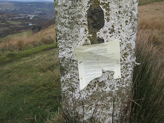 |
| Stone Coed Morgannwg Way marker with notice of footpath closures (somewhere) |
I now crossed a section of rough moorland, past a reservoir and then passed my first wind turbines, giant beasts that dominate the landscape. The next major milestone was reaching the main A4061 road. The path should have restarted just across the road, and maybe it once did, but now it was rough ground and the ghost of a track had holes full of water and sphagnum moss that your legs would suddenly disappear into. I had once damaged my knee in such a landscape and, not wishing a second arthroscopy, I decide to find another route. Two possibilities: either head north up the road to where a bridle path was marked (a route recommended in one
book) or following the cycle path beside the route heading south. I chose the latter as it avoided walking on the road in the gathering gloom. It shortly headed west in the right direction, but first it passed the security office for a project that seemed to involve installing more wind turbines. I tried to sneak past as I was not sure they would be happy with me camping out, possibly in their windfarm, and as nightfall was rapidly approaching there was little else I could do, heading into an area populated only by trees and wind turbines. However the lights went on, the barrier went up and the guard looked out of the window. Fortunately he just waved, I waved back and hurried on my way.
 |
| View across the escarpment as distant villages put their lights on |
A few kilometres later and I was back on the Coed Morgannwg Way somewhere above the lake of Llyn Fach. I knew this because of my GPS, but it was now, at 5:30 p.m., too dark to see anything but the orange lights of Hirwaun down in the valley. Reaching for my head torch I pushed into the fir trees and found a patch on the pine needles large enough for my small tent. By 8:30 pm I was asleep.
 |
| Campsite |
Update: I returned on a wet and muddy day in December to try and find out if and where my navigating was in error. First error - I had started at the wrong place, I found a Coed Morgannwg Waymark at the bridge over the A470 a little way North East of the Bike park, although the indicated bridle way just led up the the Bike path so not much of an error. More seriously I struggled to find a better way between the Bike Park and the electricity pylons. I tried following good tracks (which I took to be the public bridleways marked on the map) to the North East of the route indicated on the Ordnance Survey map, and succeeded in finding two good alternatives, but I had to ignore signs saying "Keep Out" warning of old coal mine workings. There was clearly no risk if you kept to the tracks and the many signs seemed an over reaction, but you cannot ignore such warnings. This is a pity as this route went past a short path leading to a 16th century blast furnace.
 |
| 16th Century Blast furnace |
I did however find a better route as you approach Cwmbach and Aberdare, discovering two more waymarks, hiding in the bushes. This more correct route avoids the slippery motor bike paths through the trees I followed before. I have given a link to the corrected route in the gps file I refer to in the
Overview post.
Finally, I checked the bridle path route at Craig y Lyn, which gives better views than the one I took previously via the windfarm security office (at least I think so it was lost in drizzle when I walked the section). It does however mean a 200 metre walk along a busy road or over very rough grass next to it. The bridle path starts close to a car park, where there was an assemblage of crosses and flowers commemorating dead Mums and Dads, Grandmas and Grandpas. A curious sight with a great view.
 |
| Typical muddy track, made more muddy by motor bikes |
 |
| Collection of crosses by car park near Craig y Lyn |


Hi John
ReplyDeleteI recently traveled the CMW from merthyr to Craig y llyn on my electric mountain bike and was very impressed with the views and I really enjoyed the ride.Like you I struggled to follow the designated route and ended up struggling to get my bike through the coniferous woods.I've thought a bit about who walked these paths back in the 5th century and have come to the conclusion that the section from Merthyr to Aberdare has been made up probably to link it to the Taff Trail at Merthyr giving the traveler the option of heading south to Cardiff or North up either the Taff Fechan or Fawr valleys and into the Breacon beacons.so I have decided to add a slightly different route making the path more enjoyable.You'll have to bear with my route finding,I use an app on my phone that gives me my grid reference(OutDoorsGPS) a compass,os 1to25000 and strava.I usually study my routes on google earth and use geoexplorer online maps from the National Library of Scotland this gives you a choice of several early maps of GB from about 1880 to 1905 this shows many of the long gone iron works ,mines ,tramways and canals etc.
http://maps.nls.uk/geo/explore/#zoom=15&lat=51.7468&lon=-3.4095&layers=171
I'll start at Rhydycar leisure complex Merthyr Tydfil,if you arrive by car you have 4hours outside the sports centre unlimited on weekends if you park in the leisure car parks you are supposed to use the facilities,head to the Premier Inn and take the footpath that goes behind it (A RIGHT TURN OFF THE TT)follow the path over the triangle footbridge and shortly after turn left across the foot bridge that spans the A470 dual carriageway take a right up the stoney path in about a mile you'll join the CMW turn right up the steep pylon climb you'll pass the sign for the early charcoal iron furnace (worth a look if your interested probably takes about 10 minutes to get there).At the top of the pylon climb turn right after about 100/200 metres turn left this will take you into the coniferous woodland (nice views of merthyr and the beacons from here )follow the steep rough track in a westerly direction into and through the woodland you'll quite soon come out of the woodland onthe top of the Merthyr and Aberdare mountain.At this point you have two choices to get to Abernant turn left but don't drop down the mountain untill you find a muddy path through the mountain grass this path zig zags down into Abernant,the second route turn right and walk in a northerly direction and you'll soon drop onto a tarmac road right will take you back to Merthyr and left down a stoney road to Abernant.From Abernant go down into Aberdare town ,take the maerdy road and pick up the signs for Dare Valley country park just after the car park and cafe you'll see a gate on the left (its called the yellow path and is also the CMW)this is an exceptional part of the route and more than likely was walked all those years ago it climbs 1100ft in a mile or so and rewards you with excellent views of the park far below you and the beacons in the distance. At the top of the climb follow the path around the top of the cwm (cirque)after a few hundred metres you have a choice bear left alongside a fence line and you should see the Cmw stone markers this leads you to the bottom of the reservoir alternatively head towards the nearest turbine and onto the road system if you bear right(North Easterly)along the turbine road up to the highest point the road climbs over the mountain and zig zags down into Hirwaun with some lovely views.coming back to the CMW it runs alongside the reservoir and in a generally North West direction heads through the wind farm and forestry and brings you out on the Rhigos mountain road.Bear right you have a few hundred metres of road before you get to the viewpoint car park ,bear left and cross the road you'll find a foot path to the forestry and the craig y llyn viewpoints.when I get a chance I'll ride the rest of the route and leave my comments.
Regards
Stephen Jones
The National Library of Scotland site looks really good, showing old industrial facilities which have left their marks on the landscape. Starting from the Leisure Complex also seems a good plan.
DeleteHope you enjoy the rest of the route!
John
It's a Travelodge at Rhydycar
ReplyDelete